Tor des Géants (TOR330) - Life Bases, Cutoffs and Elevation Profile
- Courmayeur, Valle d'Aosta, Italy
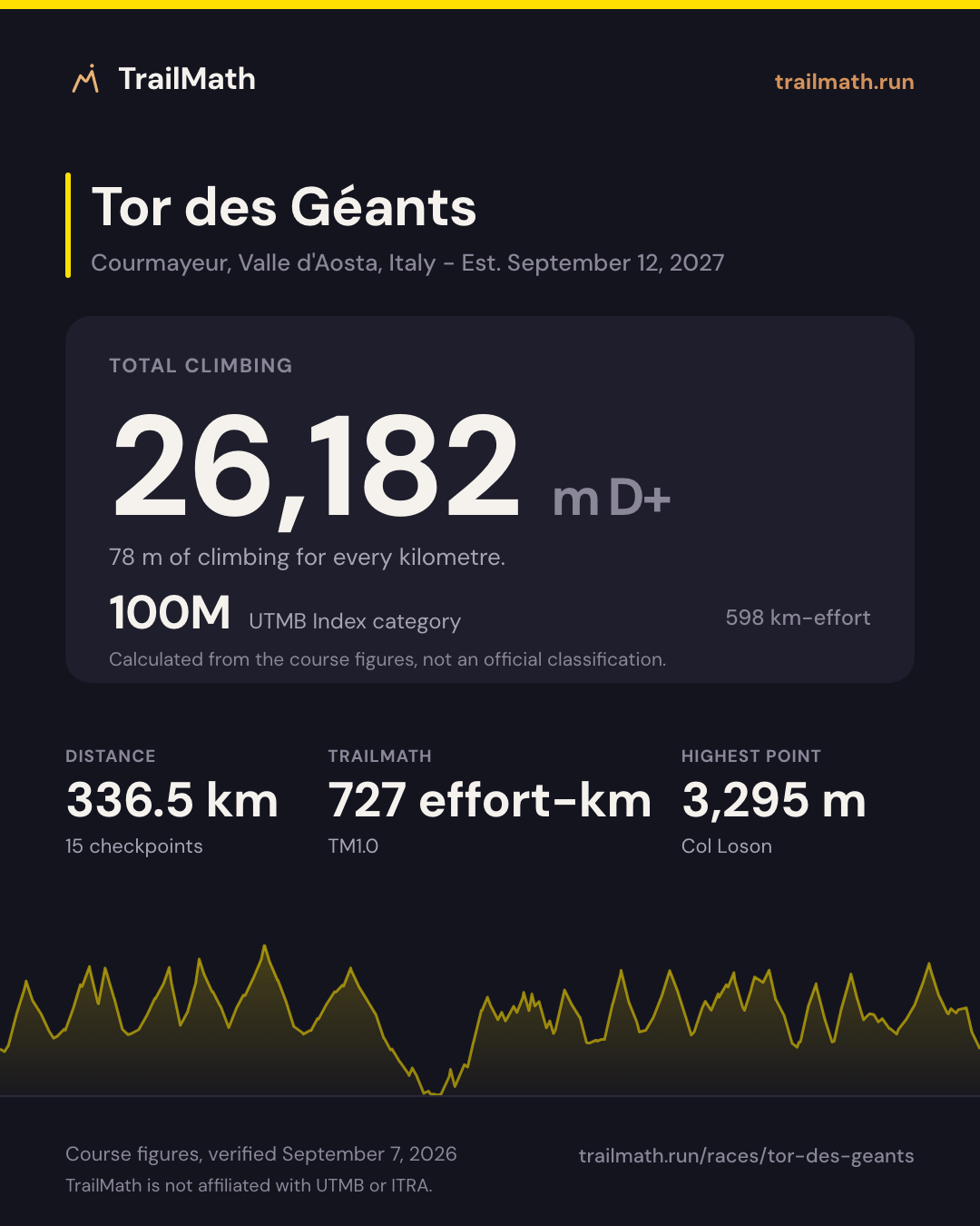
- 336.5 km
- 26,182 m D+
- 13 aid stations
Map, checkpoints and cutoffs Map · checkpoints · forecast opens Sep 3 Race-day forecast is live
Race-day conditions
Weather, daylight and your arrival time at all 15 checkpoints, set to the 10:00 start.
- Start
- 10:00
- Daylight at the start
- 07:05-19:50
- Aid stations
- 13
Course profile
Courmayeur, Valle d'Aosta, Italy
- Distance
- 336.5 km Finishes 455 m higher than it starts
- Elevation
- +26,182 m -25,727 m About 78 m of climb per km
- Highest point
- 3,295 m Col Loson
Next edition Est. Sun 12 Sept 2027
Our estimate for Sun 12 Sept 2027. The organiser has not announced the date for this race yet.
- Start
- Sunset 9h51 after the start
- Sunrise 21h07 after the start
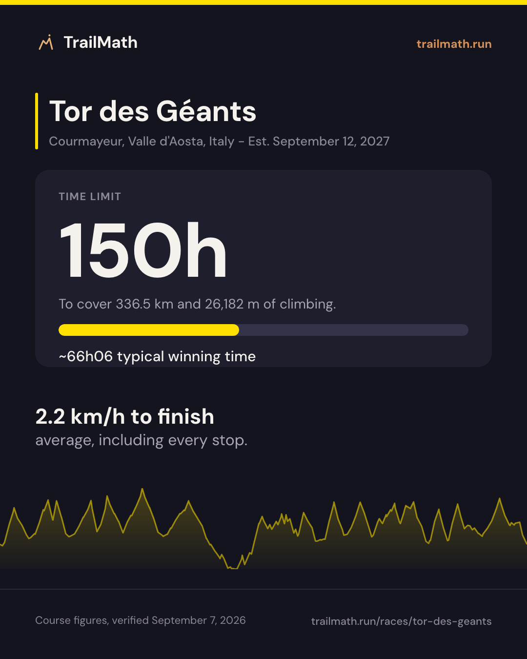
- Winner ~66h06 66h06 after the start
- Mid-pack finish UTMB Index 500 116h50 after the start
- Cutoff 150h after the start
A mid-pack runner spends about 56h30 in the dark.
Tor des Géants is a 336.5km single-stage ultra-trail with 26,182m of elevation gain, run on the Alte Vie 1 and 2 of the Aosta Valley and starting and finishing in Courmayeur, Italy. The overall cutoff is 150 hours and the highest point is Col Loson at 3,295m. There are no mandatory stages: runners manage their own sleep across six life bases, which is what makes the race unlike any other hundred-miler.
The race starts on a Sunday in two waves, at 10:00 and 12:00, and every time barrier for the second wave falls exactly two hours later than for the first. Six life bases - Valgrisenche, Cogne, Donnas, Gressoney, Valtournenche and Ollomont - carry your TOR bag and are the only points with a bed, a shower and a full drop bag. Expect three to six nights out: the 150-hour limit leaves room for more than six days on the course, and sleep management rather than pace decides most finishes.
Data is approximate and courses change between editions - always verify against the official race guide.
Plan against the cutoffs
Enter a goal finish time and see estimated arrivals vs checkpoint cutoffs.
Estimate your finish
One Strava connection reads your last 90 days and estimates your finish on this course. Free, no plan needed.


Course math
Four numbers worked out from this course's distance, elevation and checkpoints.
TrailMath effort-km
727 effort-km
About 117 h for a mid-pack finisher (index 500). Not a pacing guarantee.
Distance + gain ÷ 100 + loss ÷ 200, beside ITRA's gain-only km-effort. Model TM1.0.
How TrailMath works →UTMB Index category
100M
598 km-effort (distance + gain ÷ 100). Calculated from the course figures, not an official classification.
Estimate your UTMB Index →Biggest climb section
+3,043 m
Donnas (life base) → Rifugio della Barma · km 149.8–175.6
The largest gain between two checkpoints, not one continuous climb.
Donnas (life base) cutoff: Wed 02:00
Plan against barriers →Biggest descent section
−3,124 m
Valtournenche (life base) → Oyace · km 237.5–274.7
The largest loss between two checkpoints. ITRA's km-effort ignores descent; TrailMath counts it: 727 km-effort.
Open in GPX Explorer →Share this race
Cards sized for Instagram and Strava.
See your training shape
Pick your weekly volume and training days to preview the plan structure - no account needed.
~48 weeks · peak ~8 h/week · 5 run + 2 strength days
For a 336.5 km race, aim for about 12 h/week at peak. Set your availability to 14 h/week in the app for the headroom to build there gradually.
Typical structure for your volume - your live plan adjusts sessions inside each week.
Make this your plan
Create your free account to generate the full week-by-week plan and keep it on track as your season changes.
Aid stations and checkpoints
| Checkpoint | Km | Cumulative gain (m) | Cumulative loss (m) | Cutoff |
|---|---|---|---|---|
| Start - Courmayeur Services not published | 0 | 0 | 0 | - |
| La Thuile Crew | 19 | 1,495 | 1,187 | Sun 15:30 |
| Valgrisenche (life base) Crew Drop bag | 48.5 | 4,032 | 3,459 | Mon 07:00 |
| Eaux Rousses Crew | 78.3 | 6,663 | 6,126 | Mon 19:30 |
| Cogne (life base) Crew Drop bag | 104 | 8,488 | 7,912 | Tue 06:00 |
| Donnas (life base) Crew Drop bag | 149.8 | 10,671 | 11,007 | Wed 02:00 |
| Rifugio della Barma Crew | 175.6 | 13,714 | 12,407 | Wed 13:00 |
| Niel Crew | 190.5 | 15,002 | 14,166 | Wed 19:30 |
| Gressoney (life base) Crew Drop bag | 203.8 | 15,860 | 15,119 | Thu 01:00 |
| Champoluc Crew | 220.8 | 17,301 | 16,387 | Thu 13:00 |
| Valtournenche (life base) Crew Drop bag | 237.5 | 18,420 | 17,680 | Thu 21:00 |
| Oyace Crew | 274.7 | 21,370 | 20,804 | Fri 12:00 |
| Ollomont (life base) Crew Drop bag | 286.5 | 22,735 | 22,151 | Fri 19:00 |
| Bosses Crew | 307.8 | 24,391 | 23,643 | Sat 06:00 |
| Courmayeur (Finish) Crew | 336.5 | 26,182 | 25,727 | Sat 16:00 |
Data is approximate and courses change between editions - always verify against the official race guide. Source: official race guide, verified September 7, 2026 - Official race website
FAQ
How much elevation gain does Tor des Géants have?
The official 2026 timetable puts the certified course at 26,182m of cumulative elevation gain and 25,727m of loss over 336.5km, across more than 25 cols. The race is marketed as roughly 24,000m of gain, and the 2026 regulations quote about 25,000m from the ITRA measurement; all three figures are official, and the timetable is the one used throughout this page.
What is the cutoff time for Tor des Géants?
The overall cutoff is 150 hours - six days and six hours. For the first wave, which starts at 10:00 on Sunday 13 September 2026, that puts the finish barrier at 16:00 on Saturday 19 September; second-wave starters leave at 12:00 and get until 18:00. There are 13 intermediate time barriers before the finish, and the six life bases also publish an arrival barrier two hours before their departure barrier.
How long is Tor des Géants?
Tor des Géants is marketed as 330km, which is where the TOR330 name comes from. The official Garmin-certified 2026 timetable measures the course at 336.5km, starting and finishing in Courmayeur and following the Alte Vie 1 and 2 around the Aosta Valley. Every distance on this page comes from that timetable.
What is the highest point of Tor des Géants?
The highest point is Col Loson at 3,295m, crossed at roughly km 90.6 between Eaux Rousses and Cogne. It is the first of the race's very high cols and, for first-wave runners on schedule, is usually reached overnight.
What are the life bases on Tor des Géants and where can crew meet you?
There are six life bases: Valgrisenche (48.5km), Cogne (104km), Donnas (149.8km), Gressoney (203.8km), Valtournenche (237.5km) and Ollomont (286.5km). These are the only points your TOR bag reaches, and the only ones with sleeping facilities. Personal assistance is allowed in designated areas at the life bases and at the intermediate refreshment points - La Thuile, Eaux Rousses, Rifugio della Barma, Niel, Champoluc, Oyace and Bosses - which the checkpoint table below lists in full.
Training for this race?
TrailMath builds periodized trail training plans around your goal race.
One Strava connection reads your last 90 days and estimates your finish on this course. Free, no plan needed.