TransLantau by UTMB - TransLantau25 - Elevation Profile, Aid Stations and Cutoffs
- Mui Wo, Lantau Island, Hong Kong
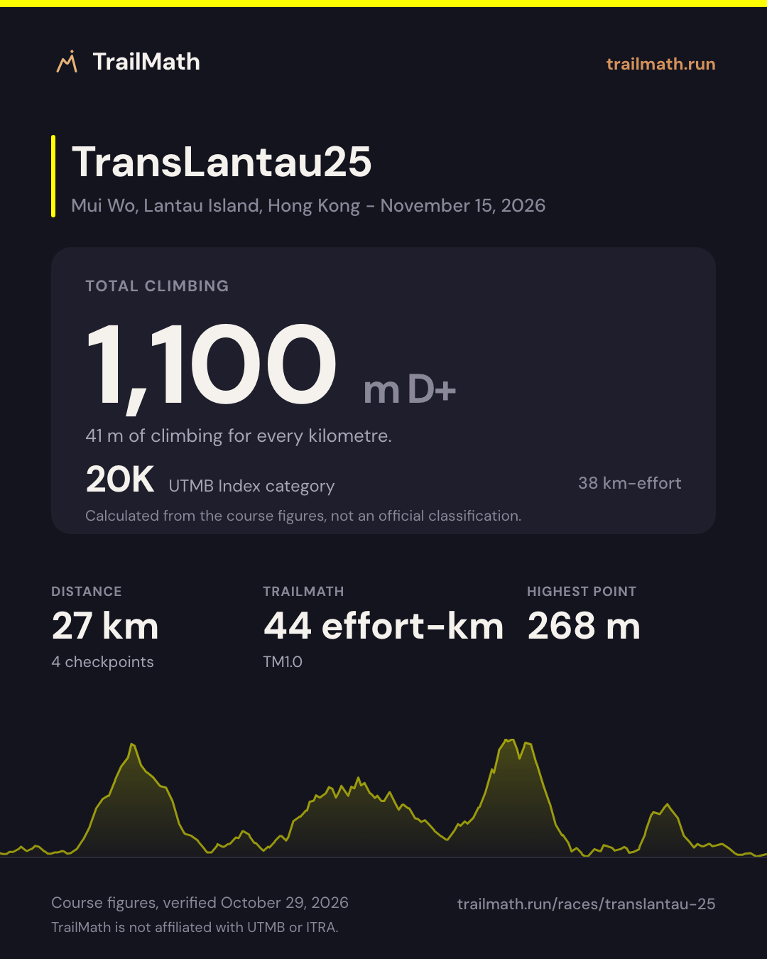
- 27 km
- 1,100 m D+
- 2 aid stations
Map, checkpoints and cutoffs Map · checkpoints · forecast opens Nov 6 Race-day forecast is live
Race-day conditions
Weather, daylight and your arrival time at all 4 checkpoints, set to the 09:30 start.
- Start
- 09:30
- Daylight at the start
- 06:36-17:41
- Aid stations
- 2
Course profile
Mui Wo, Lantau Island, Hong Kong
- Distance
- 27 km
- Elevation
- +1,100 m -1,100 m About 41 m of climb per km
- Highest point
- 268 m
Next edition Sun 15 Nov 2026 · 09:30
- Start
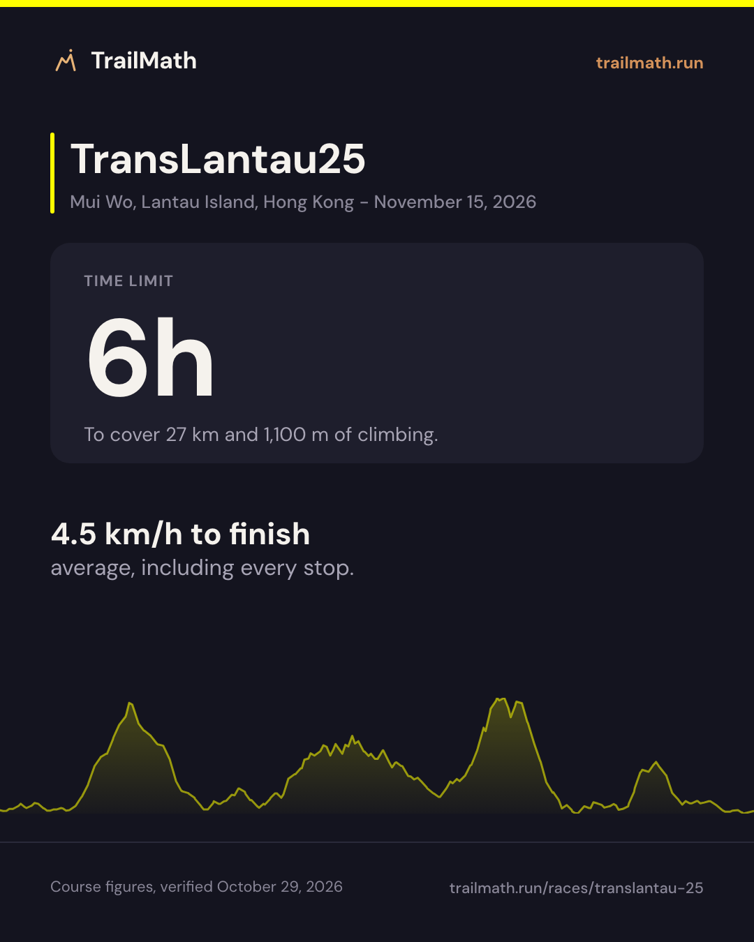
- Cutoff 6h after the start
TransLantau by UTMB - TransLantau25 is a 27 km ultra-trail with around 1,100 m of elevation gain, starting in Mui Wo, Lantau Island, Hong Kong. The overall cutoff is 6 hours. That is 41 m of climbing per kilometre. TransLantau by UTMB has 3 races, from 27 to 103 km; this one ranks 3 of 3 by distance and 3 of 3 by climbing per kilometre.
The biggest climb between checkpoints gains around 646 m from Ham Tin (km 7.07) to Chi Ma Wan (km 19.48). The steepest sustained section on the elevation profile averages about 12% over roughly 2.2 km around km 4. Crew access is allowed at Ham Tin (7.07 km) and Chi Ma Wan (19.48 km).
Data is approximate and courses change between editions - always verify against the official race guide.
Other distances at TransLantau by UTMB
| Race | Distance | D+ | Cutoff | Next start |
|---|---|---|---|---|
| TransLantau100 | 103 km | 4,600 m | 27h00 | Nov 13, 2026 |
| TransLantau50 | 45 km | 2,100 m | 11h00 | Nov 14, 2026 |
| TransLantau25 (this page) | 27 km | 1,100 m | 6h00 | Nov 15, 2026 |
Plan against the cutoffs
Enter a goal finish time and see estimated arrivals vs checkpoint cutoffs.
Estimate your finish
One Strava connection reads your last 90 days and estimates your finish on this course. Free, no plan needed.


Course math
Four numbers worked out from this course's distance, elevation and checkpoints.
TrailMath effort-km
44 effort-km
Below 50 effort-km the model quotes no reference time.
Distance + gain ÷ 100 + loss ÷ 200, beside ITRA's gain-only km-effort. Model TM1.0.
How TrailMath works →UTMB Index category
20K
38 km-effort (distance + gain ÷ 100). Calculated from the course figures, not an official classification.
Estimate your UTMB Index → ITRA and UTMB indexes explainedBiggest climb section
+646 m
Ham Tin → Chi Ma Wan · km 7.1–19.5
The largest gain between two checkpoints, not one continuous climb.
Biggest descent section
−612 m
Ham Tin → Chi Ma Wan · km 7.1–19.5
The largest loss between two checkpoints. ITRA's km-effort ignores descent; TrailMath counts it: 44 km-effort.
Open in GPX Explorer →Share this race
Cards sized for Instagram and Strava.
Race-ready pack
Too late to build a season. Not too late to race smarter.
With 16 days to go, training can still sharpen you, but most of what you can still gain is freshness. What changes your finish most now is your margin at each barrier, how you fuel each leg and how rested you arrive.
16 days to the startSun, Nov 15 · 09:30 GMT+8
Pace and fuel, checkpoint by checkpoint
| Checkpoint | km | Barrier | You | Fuel |
|---|---|---|---|---|
| Ham Tin7.1 km · +290 m | 7.1 | In the app | ||
| Chi Ma Wan12.4 km · +646 m | 19.5 | Sun 14:45 | In the app | In the app |
| Mui Wo Finish7.5 km · +164 m | 27 | Sun 15:30 | In the app | In the app |
Crew access at 2 checkpoints.
A barrier is a cut-off to clear, not a pace to aim for: race on effort, and expect the later legs to be slower.
Fuel by the hour, not by the kilometre - each leg is time between aid stations. Race on the fuel you trained with: nothing new this week.
Arrive fresh
- 2h16Rest of this week
- 5h17Week 2
- 3h36Race week
What the plan engine gives at 6 h/week: 2 sharpening weeks just under your current volume, then a lighter race week. The first bar is only the days left this week.
Your days, one by one
Your TransLantau25 race plan
Your split to every barrier at your pace, your fuelling leg by leg, and your race week day by day. TransLantau25 is already filled in.
Aid stations and checkpoints
| Checkpoint | Km | Cumulative gain (m) | Cumulative loss (m) | Cutoff |
|---|---|---|---|---|
| Mui Wo Start Crew Drop bag | 0 | 0 | 0 | - |
| Ham Tin Crew | 7.07 | 290 | 281 | - |
| Chi Ma Wan Crew | 19.48 | 936 | 893 | Sun 14:45 |
| Mui Wo Finish Crew Drop bag | 27 | 1,100 | 1,100 | Sun 15:30 |
Data is approximate and courses change between editions - always verify against the official race guide. Source: official race guide, verified October 29, 2026 - Official race website
FAQ
How much elevation gain does TransLantau by UTMB - TransLantau25 have?
TransLantau by UTMB - TransLantau25 has around 1,100 m of cumulative elevation gain and 1,100 m of loss over 27 km.
What is the cutoff time for TransLantau by UTMB - TransLantau25?
The overall TransLantau by UTMB - TransLantau25 cutoff is 6 hours, with intermediate time barriers at major checkpoints.
How long is TransLantau by UTMB - TransLantau25?
TransLantau by UTMB - TransLantau25 covers approximately 27 km, starting in Mui Wo, Lantau Island, Hong Kong.
How many aid stations does TransLantau by UTMB - TransLantau25 have and which allow crew?
The checkpoint table lists 2 major aid points between the start and the finish. Crew access is allowed at Ham Tin (7.07 km) and Chi Ma Wan (19.48 km).
Training for this race?
TrailMath builds periodized trail training plans around your goal race.
One Strava connection reads your last 90 days and estimates your finish on this course. Free, no plan needed.